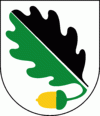
Ekerö Municipality (Ekerö Kommun)
 |
The King of Sweden resides in Ekerö Municipality, at Drottningholm Palace (see below).
Originally, when the first local government acts were implemented in Sweden in 1863, eight rural municipalities were created, each corresponding to an old parish. The municipal reform of 1952 grouped them in two new larger entities. The next reform in 1971 merged them into the present municipality.
Ekerö is the only municipality in the Lake Mälaren region composed exclusively of islands. Land elevation has reduced the number of islands and skerries to 140, the largest of which are Adelsö, Munsö, Ekerö, Färingsö, and Lovö. 2000 years ago, during the Roman Iron Age, Färingsön was more of an archipelago of twenty islands.
Map - Ekerö Municipality (Ekerö Kommun)
Map


Country - Sweden
 |
 |
| Flag of Sweden | |
Nature in Sweden is dominated by forests and many lakes, including some of the largest in Europe. Many long rivers run from the Scandes range through the landscape, primarily emptying into the northern tributaries of the Baltic Sea. It has an extensive coastline and most of the population lives near a major body of water. With the country ranging from 55°N to 69°N, the climate of Sweden is diverse due to the length of the country. The usual conditions are mild for the latitudes with a maritime south, continental centre and subarctic north. Snow cover is infrequent in the densely populated south, but reliable in higher latitudes. Furthermore, the rain shadow of the Scandes results in quite dry winters and sunny summers in much of the country.
Currency / Language
| ISO | Currency | Symbol | Significant figures |
|---|---|---|---|
| SEK | Swedish krona | kr | 2 |
| ISO | Language |
|---|---|
| FI | Finnish language |
| SE | Northern Sami |
| SV | Swedish language |